
L'Aquila 1703: Lost, Demolished, Rebuilt
Chiara Capulli
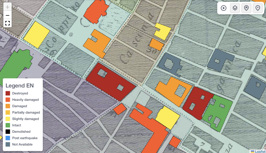
In what ways does the spatial analysis of historical data enhance our understanding of post-catastrophic dynamics in the urban fabric? This question is central to the development of the digital platform ‘L’Aquila 1703: Lost, Demolished, Rebuilt’, which aims to provide a better assessment of L’Aquila’s material and symbolic topography after the devastating earthquake of 1703.
By spatialising data from a diverse range of sources, including secondary literature, church and notarial records, and the valuable visual reference of the 1753 Vandi plan of L’Aquila, we can gain a deeper understanding of the complex dynamics that shaped the city’s urban landscape and better assess the role of catastrophic events in it. The platform aims to stimulate research questions about what was lost, what remains, and how the city’s identity has evolved over time, providing a unique perspective on the intersection of artistic, architectural, social, and devotional needs in the context of disaster and reconstruction.
By spatialising data from a diverse range of sources, including secondary literature, church and notarial records, and the valuable visual reference of the 1753 Vandi plan of L’Aquila, we can gain a deeper understanding of the complex dynamics that shaped the city’s urban landscape and better assess the role of catastrophic events in it. The platform aims to stimulate research questions about what was lost, what remains, and how the city’s identity has evolved over time, providing a unique perspective on the intersection of artistic, architectural, social, and devotional needs in the context of disaster and reconstruction.